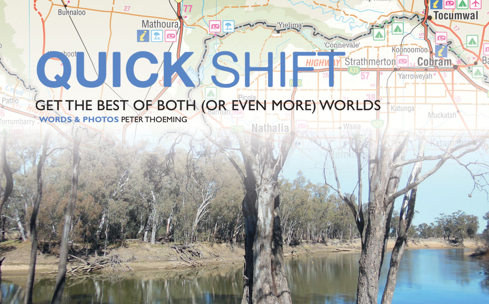
Quick Shift - Get the Best of Both (or Even More) Worlds

Going to sleep on a motorcycle is definitely not recommended, but there are some roads that are simply so soporific that it’s hard to avoid doing exactly that. I once organised a vote to find Australia’s most boring road; the Silver City Highway between Wentworth and Broken Hill took the honours, followed by the Eyre Highway across the top of the Eyre Peninsula, but a couple of northern Victorian roads made it into the Top Ten.
The inclusion of Victorian roads is not surprising. The countryside is flat, and the surveying often created straight roads for many kilometres, broken only by 90 or near 90 degree corners. Interestingly, the vast Murray-Darling Basin is not, as it might at first seem, a floodplain. The American Heritage Science Dictionary defines such a plain as “Flat land bordering a river and made up of alluvium (sand, silt, and clay) deposited during floods. When a river overflow the floodplain is covered with water.” The basin is mainly made up of alluvium deposited by the sea, not the rivers, and not nearly all of it is covered by water during floods.
So what? Aww, I thought you were interested in these little snippets of fact. The best way to avoid the visual Valium of long, straight roads is to choose your route carefully. Let’s assume you’re travelling north from Melbourne on your way to Sydney and points north. I’d recommend that you leave Melbourne on the Calder Freeway – just to get out of town – and turn off at Kyneton for Heathcote. Here you join the Northern Highway, which will take you up to Echuca without having to hassle your way through the traffic of any major cities or towns. Best of all, many of these roads are interesting – there’s not so much superslab or straight road.
In Echuca it’s time to swap routes; you don’t want to continue into NSW on the exceedingly flat and straight Cobb Highway. Take the Murray Valley Highway instead, over to Cobram, and turn left there to start on the Newell Highway at Tocumwal in NSW. It’s not the most exciting bike road, but it beats the Cobb hands (wheels?) down. But there’s more to this than just a link across from one highway to another at a convenient place; There’s even some really enjoyable dirt. See the back of the map for more details. Meanwhile, what about the towns on this route?
ECHUCA
It might sound a bit wishy-washy, but Echuca is nice. Just off the main street I like the careful re-creation of the old port buildings and the huge red gum wharf (Echuca was once Australia’s largest river port) and the reasonably varied choice of pubs and restaurants. The Star Hotel has an underground bar and an escape tunnel; cool stuff. Echuca is close to the junction of the Goulburn, Campaspe and Murray Rivers. It is the closest point on the Murray to Melbourne, which helped its development as a river port. It’s no surprise then that the best-known attraction in Echuca is the fleet of paddle steamers, many of which are available for both short and long cruises. I haven’t been on one, but it’s on the list.
Because Echuca is a major tourist destination there is a substantial range of accommodation, with motels along the main street and both pubs and campgrounds further along. All in all, Echuca is the kind of place where I’d be happy to stop at any time. Avoid the nachos at the Caledonian Hotel; details elsewhere.
BARMAH
In an area of small towns, Barmah is a very small town – but it has a pleasant if rather stark pub, a servo and a small shop. What more could you ask for? How about two (or three, if you go far enough) caravan parks? One of them is right next to the pub.
The major attraction is the wonderful Barmah State Park north of the town. It holds the Dharnya Centre, focusing on the local Aboriginal people, and together with Barmah State Forest it makes up the largest river red gum forest in Victoria. I think that probably makes it the biggest such forest in the world?
The forest is mainly a source of timber these days, although once upon a time it provided quite a different resource: leeches from the forest were collected and sent to England for medical treatment. Treatment of people, not leeches. How would that have been for a job, collecting leeches? Mind you, I was reading recently that the idea of bleeding is coming back…
NATHALIA
It might be on Broken Creek, but there’s nothing broken about Nathalia. Admittedly it is overseen, like many other towns near the river, by a giant concrete Dalek of a water tower, but the shops look well-tended and the town feels busy and happy. I believe that Nathalia is the nearest place to Barmah State Forest for pizza, local information for what it’s worth. There are lots of old buildings in town.
COBRAM
Set in what is often called “peaches and cream country”, Cobram is surrounded by both dairies and orchards. There are river beaches nearby, some of them on the way to the NSW border. You don’t actually pass through Cobram on the recommended route, but the corner where you turn north to NSW from the Murray Valley Highway, 5km short of Cobram, has a big and convenient service station. Not far away is a pick-your-own strawberry farm which operates in the warmer months.
TOCUMWAL
Forever known as the town with the big plastic fish, Tocumwal’s trademark Murray Cod is actually made of fibreglass. It looks terrific, I don’t care what anybody says. The Tocumwal Hotel Motel is more or less next to the fish, a bit further east, as are the town shops.
Don’t just buzz across the new concrete bridge that takes the Newell Highway over the Murray and carry on; turn right at the big roundabout and check out the town. From the bridge, the old iron bridge to the west is visible and makes a good subject for a photo. There is also a place on the corner of Bridge Street and Deniliquin Road that has a nicely-presented big train set.
So, paddle steamers and leeches to a big cod and train sets… this is excitement country, and don’t forget the peaches and cream in Cobram – they’re free at their festival in January of odd-numbered years. And I started this story with tales of going to sleep – tch.

YELLOW ROUTES
Quick shifting from one highway to the other, that’s the name of this game. The yellow routes are the ‘through roads’, the major highways whose names change at the border. I definitely don’t recommend the Goulburn Valley or Cobb highways, in Victoria and NSW respectively, so this map is a way of using the somewhat more interesting Northern and Newell highways instead. Major highways are often a dead loss for motorcyclist, partly because their surveying tends to be on the dull side (lots of straights and simple corners) and policing can be well over the top; but of course there are stretches where you can’t really avoid major roads unless you have lots of time and good dual purpose tyres…
I try to stay away from larger country towns as well, because they all seem to have that outgrowth of big bulk shops around them which slows down the traffic and therefore your ride. In this example, we are keeping clear of both Bendigo and Shepparton. That saves both time and aggravation.
ORANGE ROUTE
The simplest connection between Echuca and Tocumwal, and therefore the Northern and Goulburn Valley highways, is the Murray Valley Highway. This is a major highway, true, and it suffers a bit from the straight road/90 degree corner disease but it’s not all that unpleasant and also allows us access to the other two routes.
Nathalia is pretty much exactly in the middle and makes quite a nice stop. Traffi c is not especially heavy, because there is relatively little movement in an east-west (and vice versa) direction up here. Most trucks and even cars tend to travel northsouth. The road is mainly in good repair, although there are some rough bits where the trucks that do use it have damaged the tar surface. It’s no worse than any other Victorian highway, just keep an eye out.
The Murray Valley Highway is not a good run from east to west in the late afternoon, because you’re riding into the setting sun quite a bit. I guess it’s probably just as bad in the morning riding west to east, but I’ve never been up that early in this area…
GREEN ROUTE
Cross the river from Echuca to Moama, a smaller version of the former with a golf club that has poker machines. Why am I telling you this? I dunno. Pleasant enough town, anyway, but it quite clearly understands that it can’t compete for tourist money with the town across the water – especially since Victoria now has pokies as well. I think.
Okay, continue north along the Cobb Highway until you get to the Barmah turnoff to the right. This is a perfectly ordinary back road, but it is well sealed and quite fun to ride. Cross the bridge over the Murray and turn left. This will take you past the Dharnya Centre with its Aboriginal-themed displays and into Barmah Forest on a good dirt road.
Well, when I say “good”, it kind of depends on the season and how long it’s been since it has rained heavily. Just after serious rain this can become a kilometres-long bog. Fortunately there is little traffic in the forest, so the road rarely becomes badly ridged and rutted when it’s wet, and is again passable when it dries out. Don’t count on that too much, though, because it does occasionally have long-term mud puddles which can become a ride hazard, wet or dry.
The ride through the forest is wonderful, with the gigantic red gums all around you and the expanse of the majestic river once you reach it. There are occasional remnants of steam engines and other sawmill equipment; the forest was once logged quite heavily. Oh, and the leeches are still there as well, but it’s not hard to defend yourself from them. Set up them any exposed skin!
Camping opportunities are everywhere along the river, and this can be one of the most tranquil and relaxing places anywhere in the country to set up your camp.
The green route comes out on the Murray Valley Highway short of Strathmerton, and it’s just a short run to Cobram.
BLUE ROUTE
This is potentially an alternative to the green route if it’s wet. The most rain and flood-affected part of the main Barmah track is the stretch north from the town to the river, and you can avoid some of it by using these tracks. But really this is just another way of enjoying the forest, and you can easily combine the blue and green routes and even make up your own as you ride through the giant red gums.
Whatever you do, if you don’t get stuck in the mud and the leeches don’t drain your blood you’re sure to enjoy these tracks! All right, just kidding…